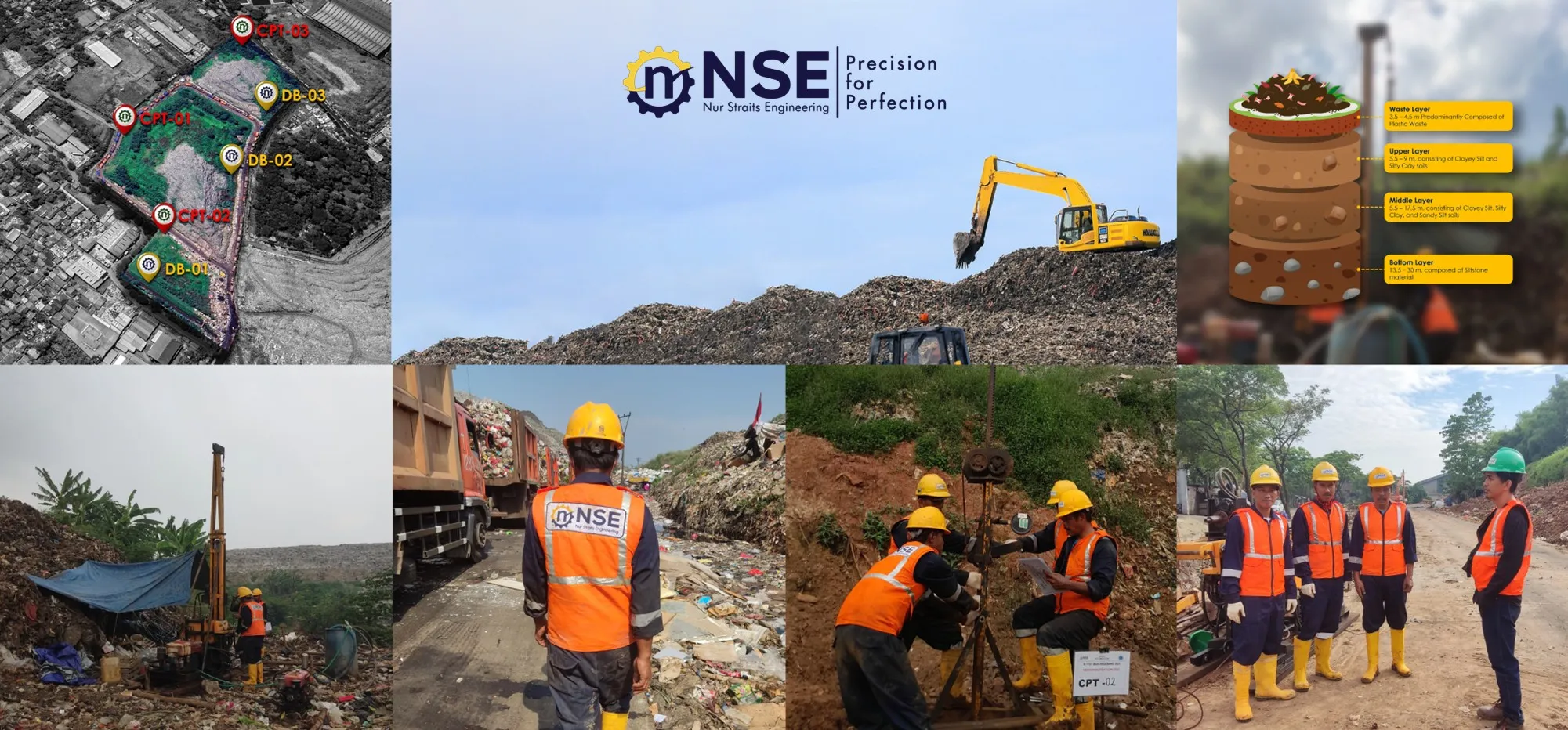
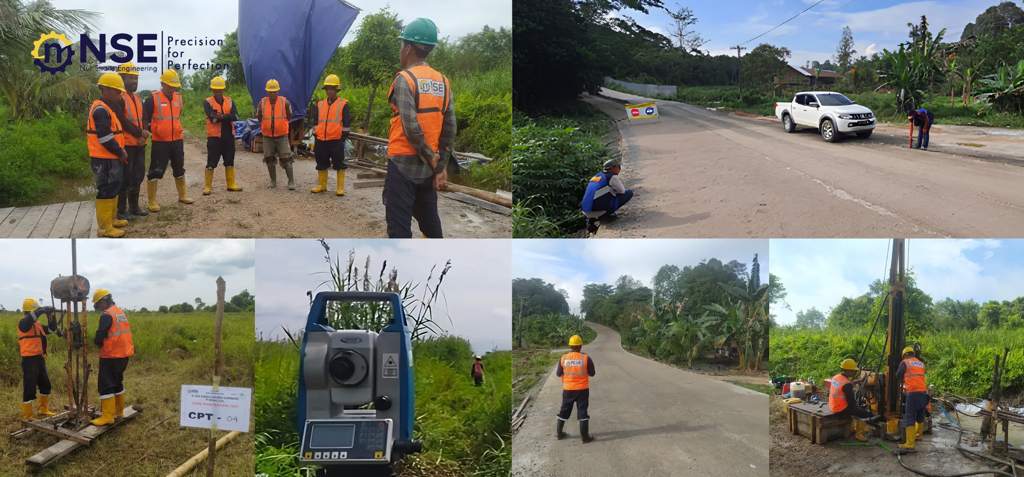
Soil Investigation, Topography, & Aerial Photography Survey at TPS Bantar Gebang


-
Project Name
Survei Penyelidikan Tanah, Topografi dan Foto Udara di TPS Bantargebang
- Client Bandung Institute of Technology (ITB)
- Location Bantargebang, Bekasi
- Time Frame 2022
-
Scope of work
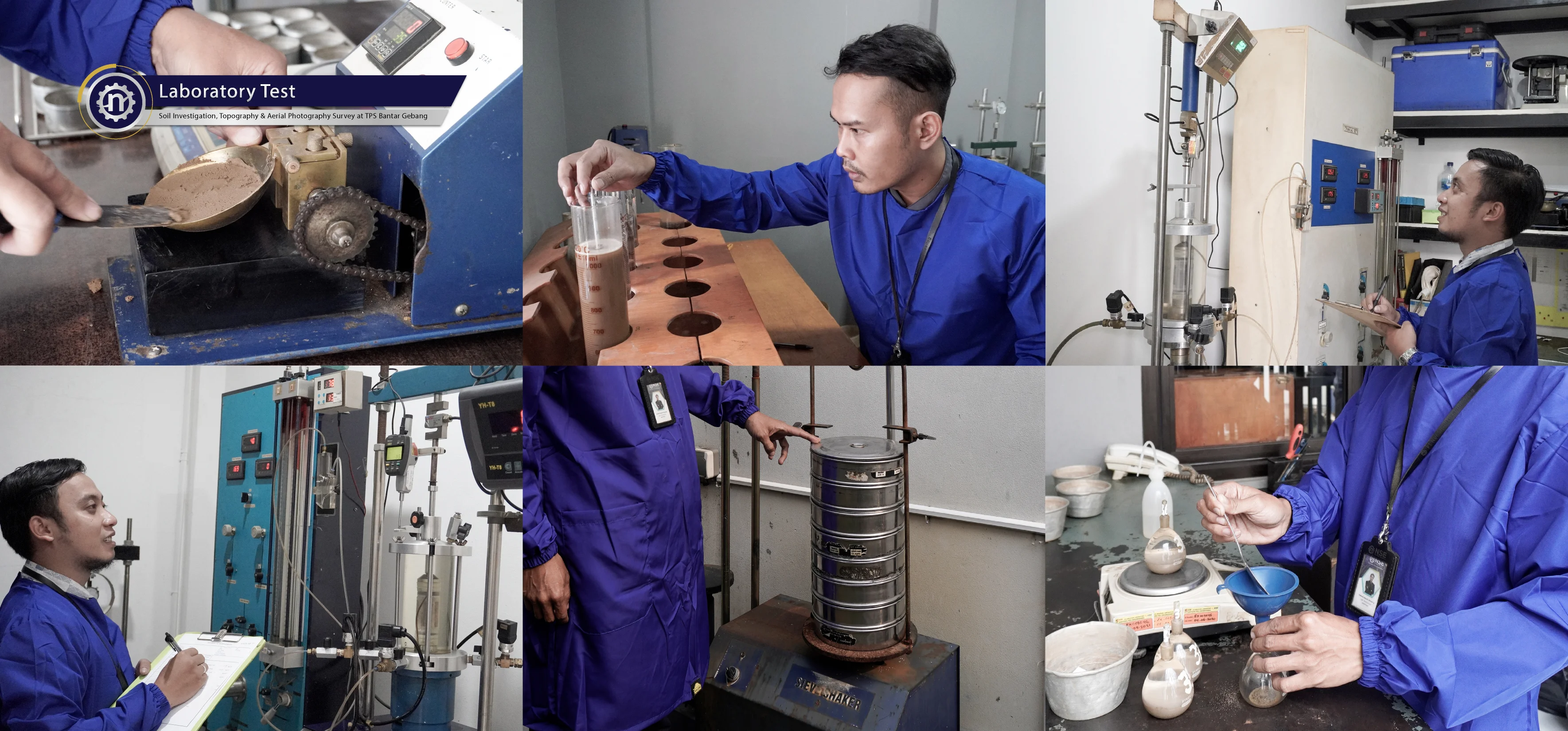
Soil Investigation Consist of 6 Point of Deep Boring and 5 Points of Cone Penetration Test. Topography & Aerial Photography Survey involve 55 Ha. In Addition, Laboratory Test on This Project are Index Properties, Triaxial UU/CU, Consolidation One Dimention and Permeability Test.
Related Projects